Map Analysis
Saturday, July 16, 2011
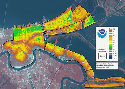
LIDAR Map
http://www.flickr.com/photos/gisuser/43339456/
This is a LIDAR map of flood areas in New Orleans, LA after Hurricane Katrina. LIDAR is an optical remote sensing technology that can measure the distance to, or other properties of a target by illuminating the target with light.
No comments:
Post a Comment
Newer Post
Older Post
Home
Subscribe to:
Post Comments (Atom)
No comments:
Post a Comment