http://pubs.usgs.gov/fs/fs-004-03/
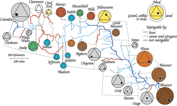
This is an example of a range graded proportional circle map. The map is based off of findings by Lewis and Clark and show the different color, width, and type of bed material for many of the rivers and streams in the US. The color of the large circle approximates the color of the water (gray indicates no color was mentioned in the journals). Descriptions of the bed material are determined by the position of the solid black circle within the black triangle.

No comments:
Post a Comment